sandywp / plugins / leaflet-map

Leaflet Map
Interactive maps and markers on your posts and pages with simple shortcodes.
Ready in seconds.
v3.4.7 30,000+ installs WP 4.6+

What you get inside
8 screens-
Put the shortcode into the post.
-
See the shortcode play out on the front end.
-
For [leaflet-image] upload an image, and copy the URL from the right-hand side
-
For [leaflet-image] paste that image URL into an attribute titled source: example: src="https://picsum.photos/1000/1000/".
-
See the [leaflet-image] on the front end.
-
If you use [leaflet-marker draggable], then you can drag the marker where you want it, open a developers console, and see the specific shortcode to use.
-
Add geojson via URL: [leaflet-geojson src="https://example.com/path/to.geojson"]
-
MapQuest requires an app key, get it from their website; alternatively, you can use OpenStreetMap as a free tile service (remember to add an attribution where…
About this plugin
Add a map generated with LeafletJS: an open-source JavaScript library for mobile-friendly interactive maps. Map tiles are provided by default through OpenStreetMap, or MapQuest (with an app key). Can be set per map with shortcode attributes or through the dashboard settings.
Maps
Simply create a map with:
[leaflet-map]
Lookup an address with:
[leaflet-map address="chicago"]
When using the OpenStreetMap Nominatim geocoder, the plugin sends a contact email in the request user agent. By default this uses the site admin email, but you can override it in the plugin settings or with the leaflet_map_nominatim_contact_email filter.
add_filter('leaflet_map_nominatim_contact_email', function ($email) { return '[email protected]'; });
Know the latitude and longitude of a location? Use them (and a zoom level) with:
[leaflet-map lat=44.67 lng=-63.61 zoom=5]
Add a marker under your map shortcode, like so:
[leaflet-map]
[leaflet-marker]
Want more? Make more (and fit the map to contain all of them):
[leaflet-map fitbounds]
[leaflet-marker address="tokyo"]
[leaflet-marker address="oslo"]
[leaflet-marker address="cairo"]
[leaflet-marker address="toronto"]
You can even add popups (to any shape) with their names:
[leaflet-map fitbounds]
[leaflet-marker address="tokyo"]Tokyo[/leaflet-marker]
[leaflet-marker address="oslo"]Oslo[/leaflet-marker]
...
Add a link to the popup messages the same way you would add any other link with the WordPress editor.
Other Shapes, GeoJSON, and KML
Add a line to the map by adding [leaflet-line]. You can specify the postions with a list separated by semi-colon ; or bar | using lat/lng: [leaflet-line latlngs="41, 29; 44, 18"] or addresses: [leaflet-line addresses="Istanbul; Sarajevo"], or x/y coordinates for image maps.
Add a circle to the map by adding [leaflet-circle]. You can specify the position using lat and lng and the radius in meters using radius. You can also customize the style using Leaflet’s Path options. Example: [leaflet-circle message="max distance" lng=5.117909610271454 lat=52.097914814706094 radius=17500 color="#0DC143" fillOpacity=0.1].
Or you can add a geojson shape via a url (make sure you are allowed to access it if it’s not hosted on your own server): [leaflet-geojson src="https://example.com/path/to.geojson"]. Add custom popups with field names; try out the default src file and fields like so:
[leaflet-map fitbounds]
[leaflet-geojson]{name}[/leaflet-geojson]


name is a property on that GeoJSON, and it can be accessed with curly brackets and the property name.
Image Maps
Alternatively, you could use a plain image for visitors to zoom and pan around with [leaflet-image src="path/to/image/file.jpg"]. See screenshots 3 – 5 for help setting that up.
More
Check out other examples on the Shortcode Helper page in the Leaflet Map admin section.
Check out the source code and more details on GitHub!
Questions
- Can I have an SVG Marker?
Yes! Convert the default marker into an svg with a shortcode like this:
[leaflet-marker svg color="white" iconClass="fab fa-wordpress-simple" background="red"]TheiconClassis perfect for adding a font-awesome icon.- How do I change the style for lines/geojson?
Pass the style attributes to the respective shortcodes (see all options on LeafletJS):
[leaflet-line color="red" weight=10 dasharray="2,15" addresses="Halifax, NS; Tanzania" classname=marching-ants]- Can I add geojson?
Yes, just give it a source URL:
[leaflet-geojson src="https://example.com/path/to.geojson"]It will also support leaflet geojson styles or geojson.io styles. Add a popup message with[leaflet-geojson popup_text="hello!"], or add HTML by adding it to the content of the shortcode:[leaflet-geojson]<a href="#">Link here, or use text from a feature property, like {title}</a>[/leaflet-geojson]or identify a geojson property withpopup_property, and each shape will use its own popup text if available.- Can I add kml/gpx?
Sure!? Use the same attributes as leaflet-geojson (above), but use the
[leaflet-kml]or[leaflet-gpx]shortcode.- Can I add wms?
Sure. Use the same attributes as leaflet-map, but use the
[leaflet-wms]shortcode; attributes include:src,layer, andcrs.- Can I add a message to a marker?
Yes:
[leaflet-marker visible]Hello there![/leaflet-marker], where visible designates if it is visible on page load. Otherwise it is only visible when clicked.- Can I use your plugin with a picture instead of a map?
Yes: Use
[leaflet-image src="path/to/image/file.jpg"]. See screenshots 3 – 5 for help setting that up.- Can I use my own self-hosted Leaflet files?
Yes: Add your custom URL to the options in the admin page.
sandywp / also on the shelf
Try another plugin
4.7 · 500+ installs
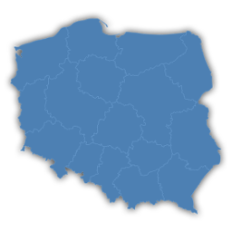
Interactive map of Poland, which allows you to attach links to the region.

5.0 · 300+ installs
Animated Gutenberg blocks for motion, media, typography, buttons, marquees, dividers, and interactive page sections.

3.5 · 200+ installs
Easily create interactive images
Spin up a real WordPress site in seconds.
Test plugins, build a demo, hand a client a link — then squash it and start again. No local setup, no Docker.